Saturday started off with 2 quick loads of laundry and tidying up the condo. As I started the 3-minute walk to Ala Moana and Queen to catch the 57 (headed north via Pali Highway eventually bound for Kailua and Sea Life Park), Tim White texted me. He’d been to breakfast with Brian and Mylo, but was ready for a hike. I responded with my plans to hike the Makapu’u Point Lighthouse Trail, and we quickly decided he’d pick me up to spare me the 81-stop bus ride out to the trail head.
Our more direct 30-minute car trip brushed Waikiki along Kalakaua and Kapi’olani before emptying onto the H-1 headed towards Koko, with unexpectedly light traffic.
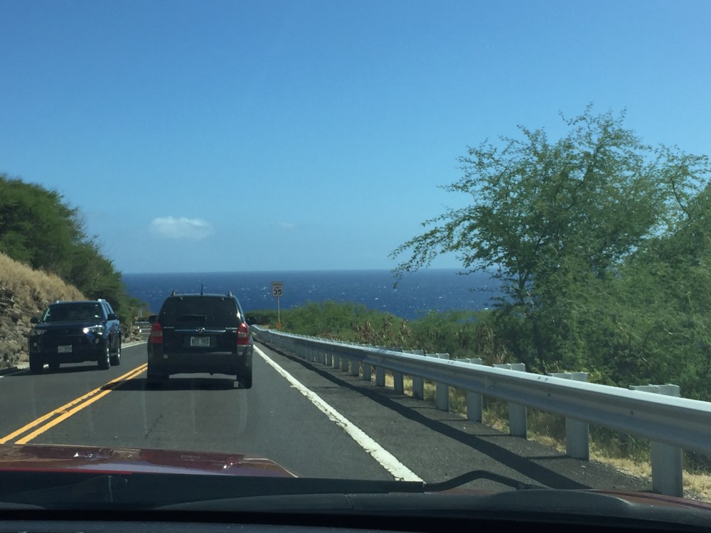
On the highway to Makapu’u.
The drive out to Hawai’i Kai and on over to Waimānalo features some of O’ahu’s most iconic sights, but you don’t necessarily want to stop at any of them on a Saturday afternoon. This artery is often clogged with tourists and locals, all clamoring for a piece of paradise. After the dredge-filled, planned community of Hawai’i Kai, there’s the famous and popular Hanauma Bay preserve, my childhood favorite Halona Blow Hole, the lesser-known Japanese fishermen’s memorial, and the rough and tumble Sandy’s Beach, one of the best spots in the world for extreme bodysurfing and boogie boarding.
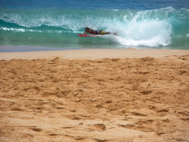
Boogie boarding at Sandy’s.
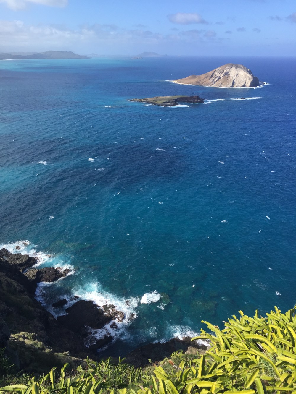
I don’t know if it’s the way the light strikes this stretch of south O’ahu before you turn and head up windward, or if it’s the abrupt confrontation between the rugged lava rock and the deep ocean with barely any beachfront buffer, but there is no blue more gripping than the blue of the Pacific along these miles of the Kalaniana’ole Highway. It’s stunning and unforgettable. Long ago, this stretch of coastline fused my own internal Pantone color chart for “Pacific Ocean blue.”
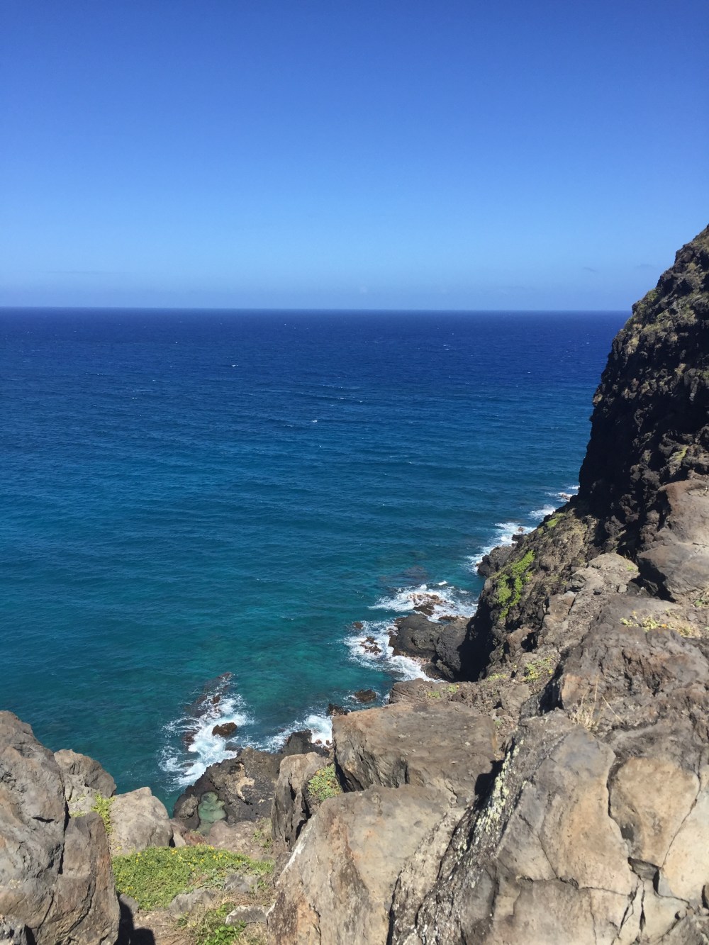
At least three shades of “Pacific Ocean blue.”
It’s the deepest and richest of all blues. Here – coalescing long before I could possibly know it – I learned visual and emotional context for just what an ocean looks like. Just what an ocean should be. And, sadly, it has forever relegated the Atlantic Ocean to second-class status . . . for me, the lesser sea.
As we took the curve after Sandy’s, we saw too many cars lining the roadway leading to the large parking area for the recently resurfaced Makapu’u Point Lighthouse Trail. Tim snatched a roadside opening. We quickly changed into our hiking shoes, then Tim unexpectedly led us over to the Makapu’u Lookout, rather than towards the smooth trail already crowded with families and strollers, bikers, runners, and even many elderly.
I was admiring the breathtaking vista when Tim jumped the lookout rail and said, “Okay, this is it. Just follow the worn footpath all the way up.”
Just above Makapu’u Lookout, where we jumped the rail and took the path less traveled.
Somewhat surprised, my only admonishment to Tim as we attacked the rocky ascent was that there’d better be another way down. I was okay to slowly and steadily hike up – mountain goat style – but my halting knees would never tolerate coming back down the same path, without a serious tumble. He assured me we’d take the actual trail to descend once we crested and caught a good look at the lighthouse.
At 22 stories (according to my Fitbit), I fervently wished that I had better conditioned myself on the stairclimber at Cross Training San Marco. As I looked above to gauge just how much further we had to go, I noticed rock-climbers dangling from an even steeper precipice, one hiking tier closer to the sea than we were.
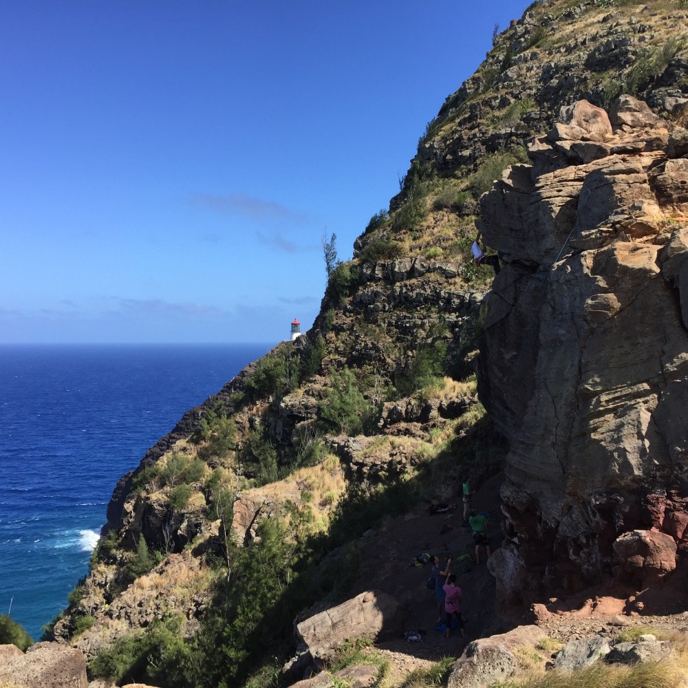
Rock-climbers face the precipice.
For a second, I fantasized they’d scoop me up, strap me securely in their safety harness and bounce me gently back down the face of the cliff. But of course, that wasn’t going to happen. Since I couldn’t go back down without risking a painful fall, the only way for me to see the unobstructed lighthouse now was to keep on climbing. One loose lava rock after another, I followed the faint footpath, lunging well beyond my natural stride and grasping gnarly scrub brush roots to steady myself and to help propel me upward.
Glancing at the Fitbit just before we reached the top of the craggy hillside, I was at 47 flights. I can assure you that I worked harder for those 47 motley, incongruous flights than any orderly staircase I’ve ever climbed. Despite frequent water breaks and vista-rewarding rest-stops,
just before we crested, I felt faint and very near exhaustion. I had unfortunately skipped lunch. With one last swig from my plastic Kirkland water bottle, I pushed through the final 25 steps.
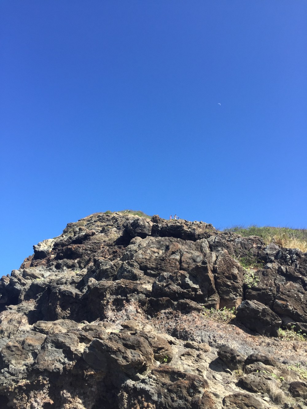
How many steps to go?! (Notice the moon.)
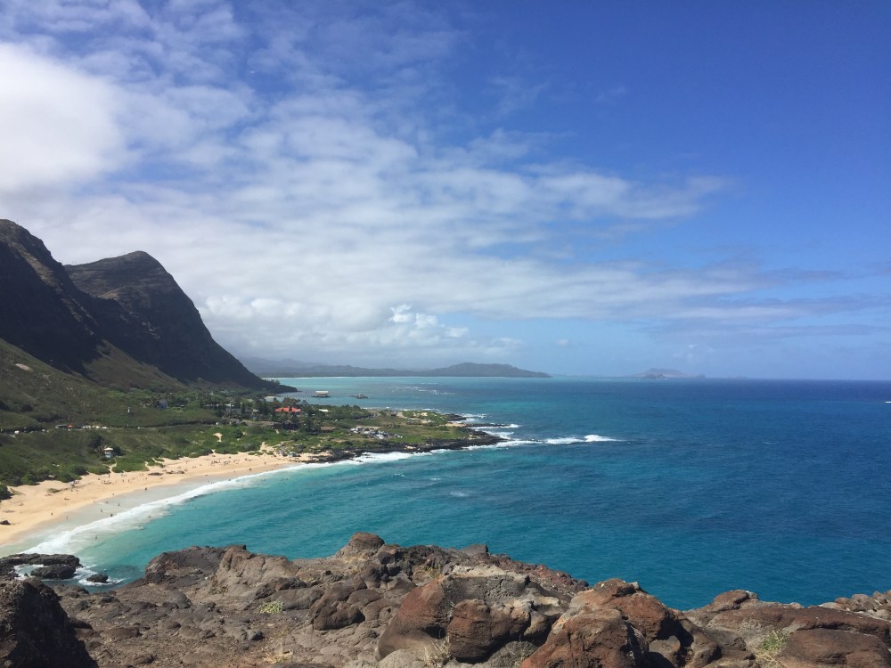
The rocky ascent gave way to a short grassy plateau and the most remarkable views you can imagine – an unobstructed look at the lighthouse and out in the deep blue Pacific, evidence of more humpback whales than I had dreamed we’d see.
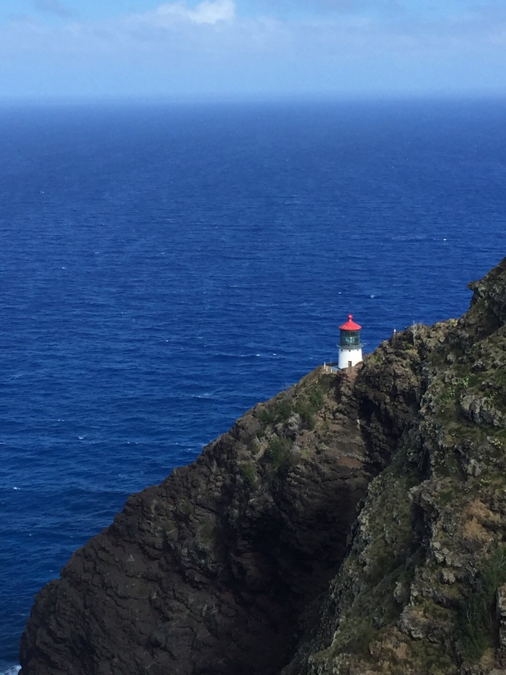
Makapu’u Lighthouse.
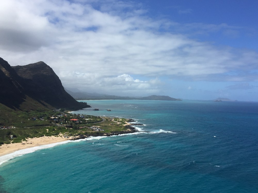
Looking windward, the lighter shades of Pacific Ocean blue.
Long way down a rocky cliff.
The trade winds that had been imprisoned by the rocks were now set free, racing over my hot flesh and nearly snatching the faded Duke ball cap from my sweat-matted hair. The release was akin to the euphoria that comes just after an intense hot yoga class. You’ve given your all. You’re absolutely spent, and yet at the same time, restored.
My exhaustion from the climb was generously rewarded with the exhilaration of being able to witness first-hand some of the most stunning sights I’ve ever seen, including a crystal clear view of Rabbit Island and the sheer wonder of countless spouting humpback whales way beyond the old lighthouse, now off-limits to the general public. It was a visceral reminder that sometimes the less traveled path is the very best way to go.
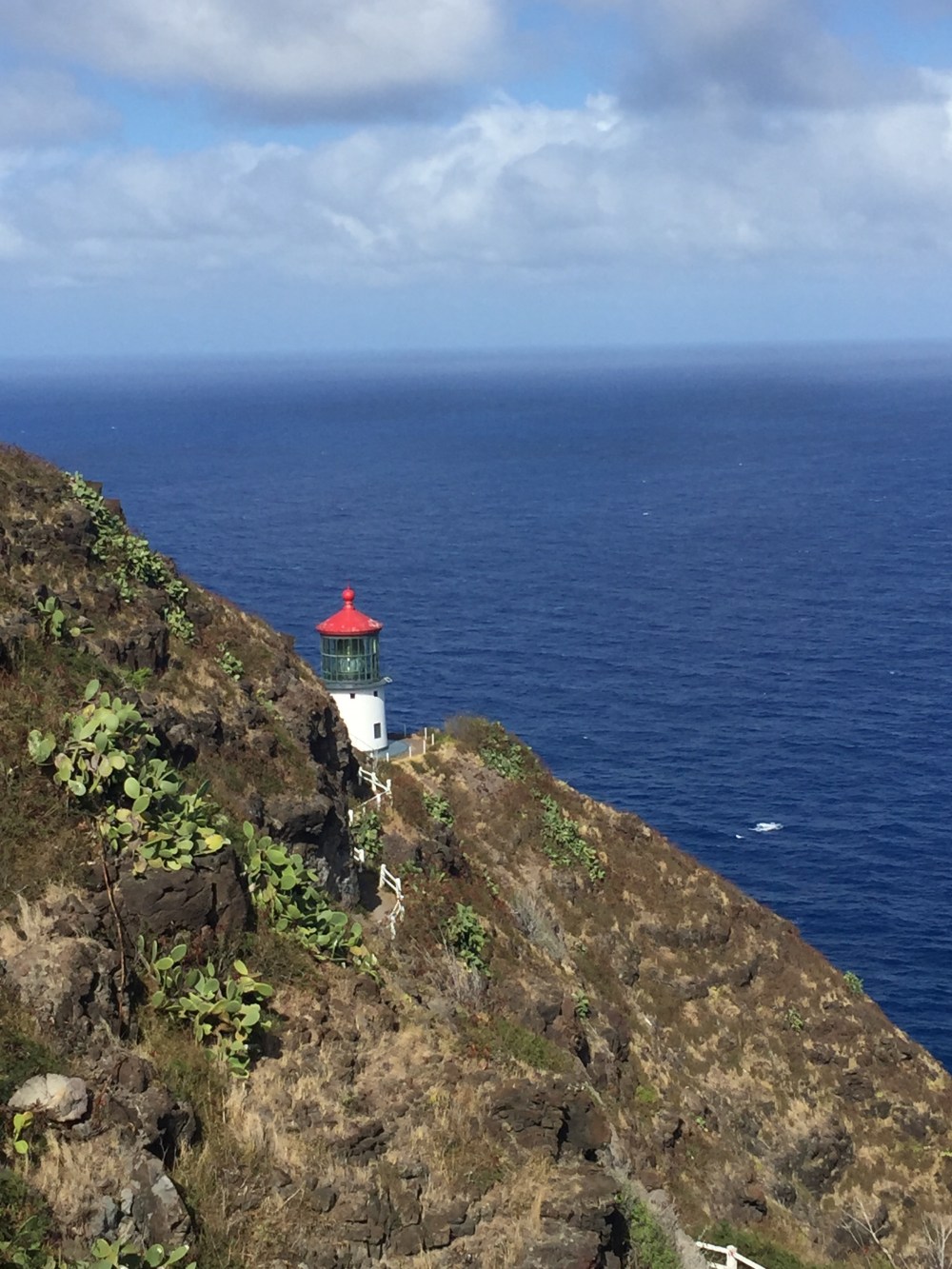
Good view of the lighthouse from the trail side, with spouting humpback to the side.

Resting and taking it all in, 47 stories high. Exhausted but happy.
